
.jpg?width=1920&height=1080&name=AXIS-4.0_Hero-16.9%20(1).jpg "AXIS-4.0_Hero-16.9 (1)")
AXIS 4.0: Streamline Newsroom Workflows and Bring Every Story to Life
We’re pleased to announce the release of AXIS 4.0, the latest version of Chyron's cloud graphics production platform for broadcast news and editorial teams, with major improvements to the News and Maps modules.
This release introduces end-to-end news workflows that bring PRIME templates into AXIS News, reduce legacy dependencies, and simplify graphics production. In the Maps module, new animation tools enable more dynamic storytelling through animated map sequences. Expanded customization capabilities, such as custom typography, editable hillshade, and broader boundary coverage, help teams maintain visual consistency across productions.
Last but not least, a series of UI and UX upgrades across both modules improves everyday usability.
End-to-End News Workflows
AXIS 4.0 brings Chyron's advanced graphics authoring capabilities into the AXIS ecosystem by integrating PRIME templates on AXIS News. Journalists and producers can create image composites that seamlessly fit into their PRIME scenes with the images and text that support their story, directly in AXIS.
PRIME Templates Support (News Module)
PRIME scene layouts can now be referenced directly in AXIS News to guide asset creation. Once a scene is built in PRIME with its replaceable fields predefined, it can be imported into AXIS and used as a visual guide for image and text composites. This helps customers work more efficiently with simplified newsroom graphics workflows and reduces legacy dependencies.
PRIME Template Upload (Track Module)
Admins can upload PRIME scenes via the Track module to establish the visual dimensions and layout guidelines for AXIS News composites. Uploaded PRIME projects are indexed in the search engine for fast retrieval across the News and Track modules.
News Composite Editor (News Module)
The new PRIME-powered Composite Editor allows journalists and editors to build flat image composites designed to fit specific PRIME scene layouts. Users can arrange text and images on the canvas and export the final result as a standard image asset. Previously created composites can be reopened and adjusted, preserving the original layout and text placement.
Preview-Only Mode (News Module)
AXIS News supports a Preview-Only mode, consistent with the legacy Lyric workflow. Users can visualize how their image and text composites will align with the PRIME scene layout in real time before finalizing the export. The preview is rendered server-side and streamed to the frontend for pixel-accurate results that match the final image output.
Preview-Only - AP & Getty Images (News Module)
AP and Getty Images sources can now be used in Preview Mode during composite creation in AXIS News (upon subscription). Users can browse, select, and position assets from image banks on the canvas, so they fit the required graphic context. The asset is downloaded from the image bank when the user selects assemble, which keeps resource use efficient: teams can browse for the right image without any impact on AP or Getty Images subscription limits.
Dynamic Storytelling
New animation tools let users create cinematic map sequences that capture audience attention and add geographic context to the narrative.
Animations Support (Maps Module)
AXIS Maps now includes a suite of powerful animation tools that turn static maps into cinematic broadcast sequences. Multiple keyframes can spotlight different locations or perspectives within a single sequence. This adds context to complex narratives and makes them easier for audiences to follow.
Users can also adjust the duration of each animation and keyframe so the visual movement aligns with voice-over delivery or the urgency of breaking news. A range of transition effects supports fluid movement between scenes, and finished animations can be exported in the formats, frame rates, and resolutions required by any broadcast environment.
Expanded Customization Capabilities
AXIS Maps now offers further customization options such as brand-compliant color palettes, branded typefaces, editable hillshade, extended boundary coverage for more granular editorial use cases, a broader icon set with custom icon support for richer map detail, and a Style Manager that creates a cohesive visual standard across the entire organization.
Style Manager (Maps Module)
This feature enables admins to define and distribute approved map styles across their entire organization from a single workspace. Styles cascade automatically across the Hub, Station, and Project hierarchy, ensuring every operator works within the right visual framework.
Branded Color Palettes (Style Editor) (Maps Module)
Admins can now curate a list of approved colors in the Style Editor. They can also control the Map Editor experience and choose whether users see the full color picker or only the predefined, brand-compliant color set.
Typefaces (Style Editor) (Maps Module)
Based on feedback from our clients, the Maps module's brand customization options now include tailored typography for full visual alignment with network or brand identity standards. Admins can upload custom brand fonts directly into the Maps Style Editor and apply them to every text element on the map, such as locators, area labels, and street labels.
Hillshade Layer (Maps Module)
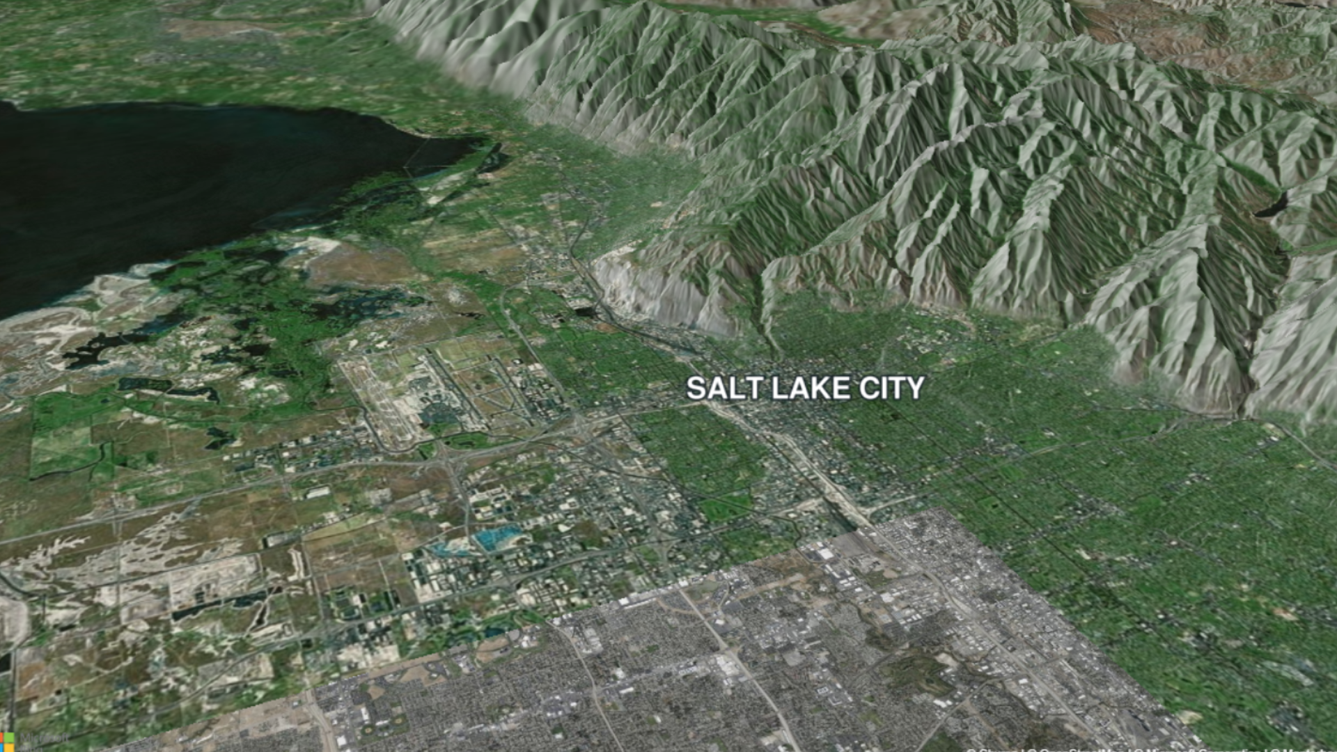
The Maps module now supports hillshade rendering and customization. Terrain visualizations get more depth and clarity, which delivers 3D-looking maps that strengthen storytelling. The hillshade layer is highly flexible, with a set of adjustable values that include shading intensity, dark and light side colors, and light direction and height.
Expanded Boundary Coverage (Maps Module)
Geographic boundary data has been significantly extended to support more granular stories. This release adds new continental and regional boundaries that let users select and highlight entire continents, which opens up further map customization for global stories. In addition, based on client feedback, AXIS 4.0 expands boundary customization for the United Kingdom, France, and Mexico.
Map Icons Improvements (Maps Module)
A new icon set with custom icon support is now available to cover a wider range of editorial use cases, along with Search Result Caching in the icon picker. These improvements help users add relevant detail to their maps faster and with less repetitive work.
Enhanced Usability
This release includes a set of improvements focused on more efficient day-to-day operations, such as a new GeoSearch continent filter that narrows location suggestions to a selected continent, intersection mapping that lets users find locations where two streets meet, bookmark tool upgrades that improve performance, and UI and UX refinements across the Maps and News modules.
GeoSearch Continent Filter (Maps Module)
A new filter control in the navigation search bar lets users restrict location suggestions to a selected continent and removes irrelevant global results for regionally focused stories.
Intersection Mapping (Maps Module)
Users can now search for and place a locator at the intersection of two streets, beyond the previous single-location search limit. This supports precise data plotting even without a specific street number.
Bookmarks Enhancements (Maps Module)
The bookmark tool has received a set of improvements that make day-to-day operations more efficient, such as a rename function, informative tooltips, and a keyframe preview modal, along with back-end enhancements such as keyframe metadata in the list API and new thumbnail infrastructure.
UI and UX Improvements (Maps Module)
The Maps module has received several UI and UX enhancements focused on clarity and efficiency across the Style Editor and Map Editor.
User Interface Enhancements
Style Editor
-
- UI simplification: The interface has been streamlined to reduce visual clutter.
- Rename functionality: Admins can now rename locators and themes directly within the editor.
- Global theme selector: A compact theme selector overlay has been added to the top-left of the map canvas in the Style Editor, so users can switch themes without leaving the current editing context.
- Safe title thumbnails: The Style Editor safe title list now displays optimized thumbnail previews instead of full-resolution images (up to 10 MB each). This significantly reduces page load time when users manage large safe title libraries.
Map Editor
-
- Icon-based navigation in the Quick Actions panel: Text labels have been replaced with a simplified icon system for a cleaner workspace.
User Experience Enhancements
-
- Open in new tab: The Map Editor and Style Editor navigation buttons now respond to right-click, so users can open either editor in a new browser tab.
- API pagination: The AXIS Maps API now supports standard pagination on list endpoints, which prevents timeouts and oversized payloads for large datasets.
- Session keep-alive: The Map Editor and Style Editor now periodically ping the Portal keep-alive endpoint, which prevents credential expiration on long editing sessions.
UI Improvements (News Module)
The News module interface has been updated to support PRIME workflows and improve overall usability. Layer names are now preserved, and a redesigned composite panel provides cleaner access to scene selection, content assignment, and preview controls.
In addition, canvas rendering is now resolution-independent, so image positions remain consistent across different screen resolutions and browser window sizes. This consistency is especially important for hub-and-spoke workflows.
Equip Your Newsroom for the Next Generation of Storytelling
AXIS 4.0 empowers broadcasters and editorial teams to transform ideas into air-ready graphics with greater efficiency, flexibility, and confidence.
From PRIME-powered newsroom workflows to dynamic map animations, AXIS 4.0 helps teams reduce production friction, accelerate content creation, and deliver richer visual stories that keep audiences informed and engaged.
Discover how AXIS 4.0 can help your organization modernize graphics production, streamline editorial workflows, and bring every story to life.